Black Desert, Crystal Mountain and White Desert: A Landscape Guide for Eclipse Travelers
The 2027 eclipse is the fixed event, but the route through Bahariya’s volcanic hills and chalk formations gives the journey its geography.
Western Desert landscape guide · Bahariya, Black Desert, Crystal Mountain and White Desert
The route to Egypt’s 2027 eclipse camp crosses landscapes that seem unrelated until the road connects them. Palm-filled Bahariya gives way to black volcanic hills, mineral-rich rock, vast pale valleys and wind-carved chalk. Travelers who know what they are seeing gain more than a list of photo stops. They understand why local drivers matter, why routes remain flexible and why the desert must be protected during a large event.

Bahariya Oasis: the living beginning
Bahariya is not a scenic gate constructed for tourists. It is a depression in the Western Desert where groundwater supports palms, farms and settlements. Bawiti is the operational center for many White Desert journeys. Here guests eat, change vehicles and meet the drivers who understand the tracks beyond the paved road.
The Bahariya-based Elzaghandi Group presents its local experience as a core part of the eclipse operation. That matters because a driver’s knowledge is spatial and seasonal: which track remains passable, where a vehicle can stop without damaging terrain and how wind changes a camp approach.
Why an oasis night changes the journey
Travelers on the four-day program arrive in Bahariya on 31 July and sleep at Aliyah Lodge. The schedule includes palm groves, Salt Lake, Pyramid Mountain and sunset at English Mountain. This day offers cultural context and physical recovery before the 4x4 section.
Oasis time also challenges the idea that the Western Desert is empty. People live and work here. Water, food, fuel and guiding knowledge come from communities, not from the landscape itself. Responsible travel recognizes that support rather than treating Bahariya as an anonymous transfer point.
The Black Desert: volcanic color on pale ground
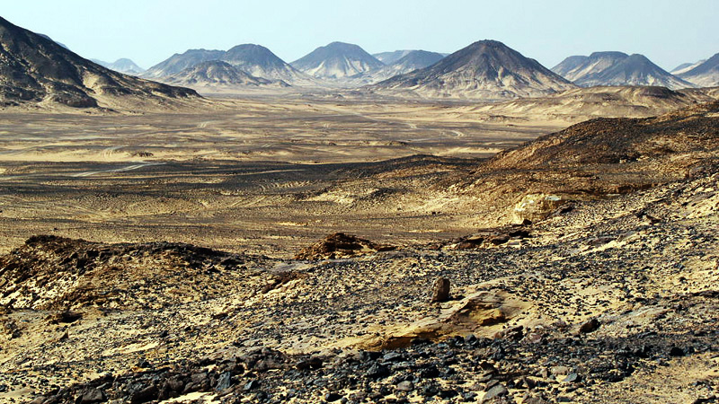
The Black Desert appears dark because volcanic material covers hills and ground in black and reddish fragments. From a distance, the hills can look burned. Up close, texture replaces the simple color: iron-rich rocks, basaltic material and gravel lie across sand.
Visitors should resist collecting attractive stones. The landscape’s meaning depends on material remaining where natural processes placed it. Climbing every hill also creates erosion and safety risks. Follow the guide to durable viewpoints.
El Hez and the springs
Oasis springs interrupt the dry route with vegetation and human use. El Hez is commonly included as a stop for lunch or a natural sulfur spring. The water’s temperature and mineral smell can surprise first-time visitors.
A spring is not a private spa. Local etiquette, water conditions and timing determine whether bathing is appropriate. Ask before entering, dress respectfully and do not use soaps or chemicals in natural water.
Crystal Mountain: a name that can mislead
Crystal Mountain is better understood as an exposed ridge rich in sparkling mineral crystals than as a high alpine mountain. Sunlight catches quartz and other material, creating the attraction. Its accessibility has also made it vulnerable to souvenir collecting.
Look closely, photograph and leave every fragment. A crystal removed by one visitor seems small; repeated across years, the damage becomes the site. The feature is especially effective as a geological transition between the darker volcanic landscapes and the pale formations ahead.
Agabat Valley: space and erosion
Agabat opens into dramatic pale cliffs and sculpted mounds. Wind and ancient geological processes have removed softer material, leaving isolated forms across broad sand. The visual scale is difficult to judge without a vehicle or person.
Off-road driving is part of the experience, yet it must remain on accepted routes. Asking a driver to make fresh tracks for a cinematic shot damages surfaces and encourages others. The local operator should balance access with conservation.
Moon Cave and hidden limestone features
Smaller features such as Moon Cave add intimacy after wide valleys. Names used on itineraries may be local or descriptive rather than formal geological classifications. That does not reduce their value; it reminds travelers that the desert is understood through both science and lived navigation.
Do not enter confined spaces or climb roofs without instruction. Chalk and limestone can be fragile even when they look solid.
The White Desert: an outdoor sculpture field
The White Desert’s chalk was deposited when the region was under ancient seas. Wind abrasion and differential erosion shaped it into pillars, caps and forms that invite nicknames such as Mushroom, Rabbit and Chicken rocks. Their familiarity in photographs can hide how isolated and delicate they feel in person.
During the 2027 eclipse, pale surfaces may make changing light especially visible. As the solar crescent narrows, shadow edges sharpen and color temperature changes. During totality, the formations can take on cool tones beneath a dark sky and bright horizon.
Why the four-day route offers the richest context
The four-day Bahariya and White Desert eclipse tour begins with a full oasis day, continues through the Black Desert, El Hez, Crystal Mountain and Agabat to the event camp, then adds Arch Rock, dunes, Magic Spring and a second camp after totality. It connects community, geology and astronomy instead of treating the eclipse as an isolated field visit.
The price of depth is time: four days and three nights, including a hotel and two camps. Travelers who want the most complete narrative may find that structure more valuable than simply maximizing stops.
The three-day alternative
The three-day eclipse expedition skips the hotel night and leaves Cairo on 1 August. It still crosses the main geological sequence and spends two nights in the desert. After totality, it continues to dunes, Arch Rock, Magic Spring and the Waves Area.
This is the strongest balance for travelers who want geology and photography but cannot add 31 July. The faster arrival makes hydration and rest in Cairo more important.
Weather, visibility and geological reality
An arid climate supports clear-sky expectations, but no desert guarantees visibility. Dust can reduce contrast, wind can move loose sand and high cloud can affect the Sun. Operators can choose a suitable permitted site and monitor conditions; they cannot promise the atmosphere.
Geology creates a valuable second layer of the trip. Even if weather interferes with totality, the route remains meaningful. This is one reason to choose a package that treats the landscape seriously instead of offering a single event-day transfer.
Desert camp versus permanent accommodation
A temporary eclipse camp must bring services to a landscape that normally lacks them. Shade, cooling, toilets, food, water, charging, communication and medical support require planning. Guests should expect an organized expedition base, not a city hotel transplanted without compromise.
The event’s maximum of 100 tourists creates conservation responsibilities. Vehicle movement, waste, sanitation and viewing zones should be controlled. Travelers contribute by following instructions and keeping their personal footprint small.
How to read place names on an itinerary
A long list can look impressive while hiding pace. Ask how long guests actually spend at each location and which stops are essential versus conditional. Desert travel depends on daylight, group movement, wind and local access. A trustworthy itinerary allows the route order to change for safety.
Also distinguish viewing from activities. Crystal Mountain may be a short geological stop, while Agabat or the dunes can occupy more time. The value of a place is not measured only by minutes; context from the guide makes brief stops meaningful.
Photography ethics
Use people or vehicles for scale only with consent. Avoid geotagging fragile, little-known features if local guides ask you not to. Do not move rocks, create cairns or scrape surfaces for a cleaner composition. Drone use requires permission and may be restricted by Egyptian law, protected-area rules and event safety.
At camp, keep tripods within assigned zones so other guests can see and move safely. Dark-sky photography should not turn sleeping areas into a field of bright white lights.
Responsible traveler checklist
- Carry a reusable bottle and secure all light waste.
- Stay on routes chosen by local drivers.
- Never remove crystals, fossils or stones.
- Avoid climbing chalk formations.
- Use toilets and sanitation systems provided by the camp.
- Keep noise and lights low after dark.
- Ask before photographing local residents.
- Follow guide instructions around springs and wildlife.
- Support Bahariya businesses and local employment.
What to ask the guide
Ask why the Black Desert is dark, how the chalk formed, how springs support oasis life and how routes change with wind. Ask what local names mean and which areas require the greatest protection. A guide is more valuable as an interpreter than as a person who points at a stop list.
Final perspective
The eclipse gives travelers a date. The Western Desert gives that date a landscape. Bahariya shows the human source of the journey, the Black Desert and Crystal Mountain reveal geological transitions, and the White Desert creates a horizon worthy of the sky. Travel slowly enough to understand the sequence—and carefully enough that it remains for the next visitor.
The strongest itineraries leave space for questions, changing light and unplanned moments of silence. Those are often where a desert stops feeling like a collection of named attractions and becomes a place the traveler can understand.
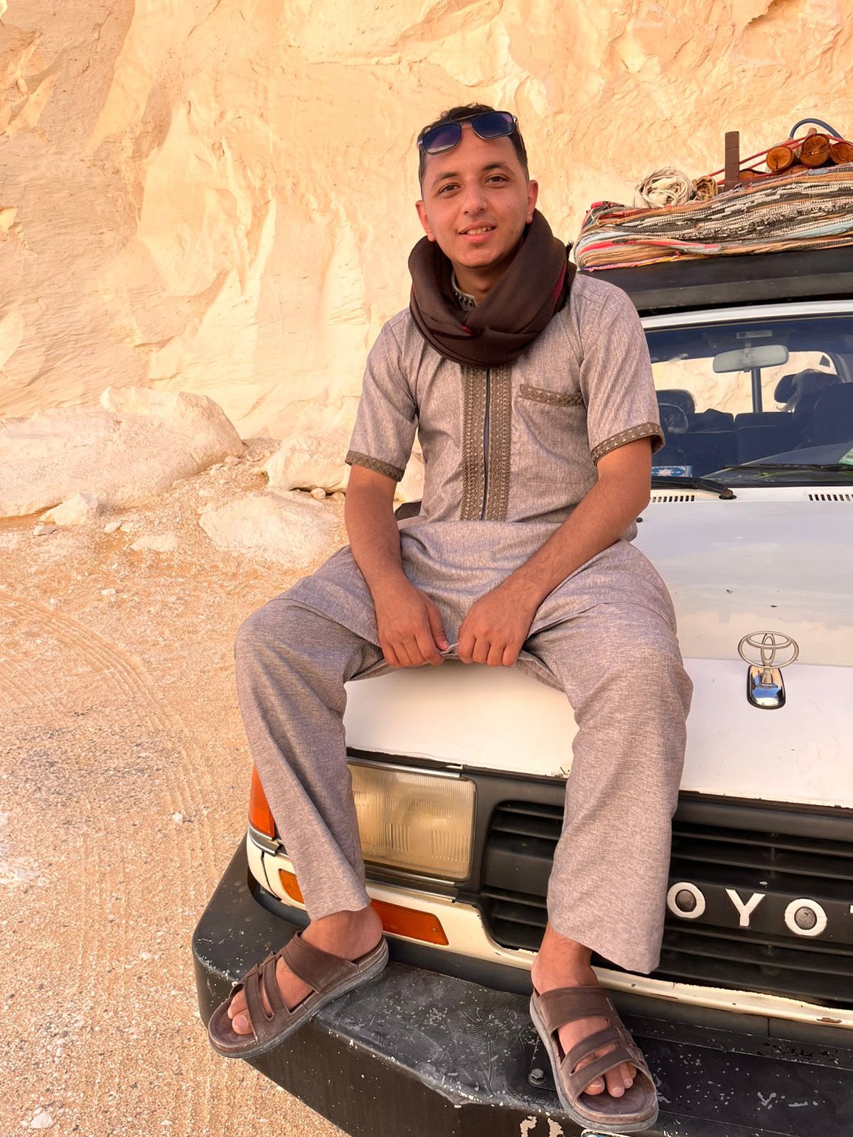
Written by Ahmed Hegazy
Ahmed was born in Bahariya Oasis and combines local Egypt travel knowledge with technical experience in tourism website design. Message Ahmed on WhatsApp.
Eclipse times, camp coordinates, prices and operating conditions can change. Reconfirm details directly before travel.